Introduction
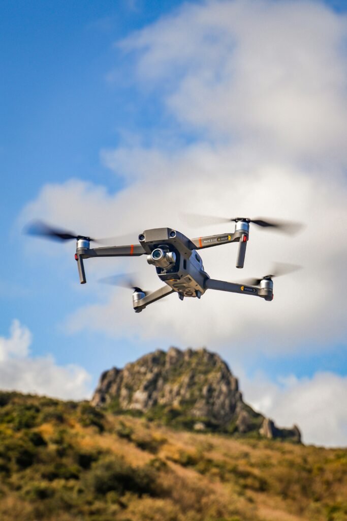
Drones, or unmanned aerial vehicles (UAVs), have become integral tools in the mining sector, particularly for mapping and surveying operations. Across Canada and the U.S., drones equipped with advanced sensors such as LiDAR, photogrammetry, magnetometers, and multispectral cameras enable efficient data collection over vast and inaccessible areas. These technologies support exploration, mapping, and ongoing site management while significantly enhancing safety by minimizing human exposure to hazardous terrain such as unstable slopes, deep pits, wetlands, muskeg, rocky ridges, and abandoned underground voids. By reducing the need for ground-based teams to travel dangerous landscapes, drones can complete tasks in hours that previously took days or weeks, lowering risks of accidents and improving operational efficiency.
Drone Applications in Surveying
Surveying includes mapping terrain, identifying mineral deposits, and assessing geological features. Drones revolutionize this process by providing high-resolution aerial data without requiring personnel to enter dangerous zones.
In terms of geophysical and geological mapping, drones with magnetometers detect variations in the earth’s magnetic field to identify ore bodies and mineral concentrations, such as rare earth elements (REE), niobium, and tungsten. [1] For example, in Canada, North American Niobium and Critical Minerals Corp. uses high-resolution magnetic drone surveys over priority target areas in Quebec to delineate granitic pegmatites associated with REE and niobium. This avoids the need for teams to navigate dense or uneven forest terrain. [2]
To explore gold and silver, drones facilitate rapid scanning of potential deposit sites. In British Columbia, Ascot Resources employed autonomous drones from Exyn Technologies to map an inaccessible underground gold and silver mine that was closed since the 1940’s. The drones identified the remaining reserves in areas too hazardous for human entry. [3] In the U.S., Montana’s gold and silver mines, including the Montanore project, use drones for aerial mapping and exploration, reducing the time that teams spend on steep, forested slopes prone to landslides. [4]
Drones impact time and hazard reduction in mining. Traditional surveying often involves manual measurements with cavity monitoring systems (CMS), requiring setup times of 30 minutes or more per scan and teams of at least two people in hazardous drifts or stopes. [5] Drones, however, can cover hundreds of hectares in a single flight, generating 3D point clouds with 95 – 99 % accuracy while keeping operators at safe distances. [6] This not only accelerates data collection but also eliminates prolonged exposure to risks such a rockfalls or poor air quality.
Drone Applications in Monitoring
Monitoring ensures ongoing safety, environmental compliance, and operational optimization. Drones provide real-time insights into mine conditions, further limiting the need for on-site personnel in dangerous areas.
To inspect sites and monitor infrastructure, drones that are equipped with sensors can inspect pit walls, tailing dams, and structural integrity from afar. This enables identifying hazards like fractures or blockages. [7] In Canada’s Sudbury operations, Vale uses drones for stope and drift scans, reducing monitoring time from 1-4 hours to fractions of that, without workers entering dusty or unstable underground environments. [8] For critical minerals, drone-based radiometric surveys in New Mexico’s mining districts map mine waste for elements like tungsten, cobalt, and fluorspar, characterizing large areas without teams traversing contaminated or uneven tailing piles. [9]
Drones measure stockpile volumes and monitor environmental impacts, such as erosion or vegetation changes around gold and silver sites. [10] In U.S. operations, companies use drones for frequent volumetric assessments, tracking excavation progress and backfill needs in open-pit mines. This reduces the need to complete manual surveys on slippery or steep stockpiles. [11]
By enabling remote inspections, drones cut down on the frequency and duration of human presence in high-risk zones. For example, monitoring ore passes in underground gold mines can now be done via drone-generated 3D models, spotting issues like hangups without entry into confined, low-visibility spaces. [12] Industry-wide, this has led to a reported 30 % reduction in fatalities and serious injuries in precious metals mining, as drones handle surveillance and maintenance checks. [13]
Key Benefits: Reducing Time on Hazardous Terrain
The primary advantage of drones in mining industries is their ability to minimize human interaction with dangerous environments. Hazardous terrain – ranging from deep excavations and unstable rock faces to remote, weather-exposed sites – poses risks of falls, collapses, and exposure to toxic substances. Drones can mitigate this in three ways. First, they speed up operations. Tasks that once required days of ground traversal can be completed in 2 to 8 hours of flight time, with data processing immediate insights. [14] Second, by keeping survey and monitoring teams out of harm’s way, drones allow focus on higher-value analysis rather than risky fieldwork. [15] Third, by reducing personnel hours in hazardous areas, drones lower operational costs and improve compliance with safety regulations. [16]
Conclusion
In both Canada and the United States, drones are transforming surveying and monitoring in mining sectors by providing accurate, timely data while drastically cutting time spent on hazardous terrain. From Quebec’s niobium explorations to Montana’s gold mines, these technologies drive safer and more efficient operations. As demand for minerals grow amid the push for green energy, drone adoption will likely expand, further prioritizing worker safety and sustainability.
Gold Proficiency
View the latest drone models at Oz Robotics here.
Sources:
[1] sphenengineering.com, https://www.sphengineering.com/news/drones-in-mining
[2] markets.businessinsider.com, https://markets.businessinsider.com/news/stocks/north-american-niobium-and-critical-minerals-corp-plans-high-resolution-magnetic-drone-survey-at-bardy-and-blanchette-properties-qu-bec-1035760875
[3] exyn.com, https://www.exyn.com/drones-for-mining
[4] farmonaut.com, https://farmonaut.com/mining/mining-drone-applications-7-drone-mines-trends-2025
[5] insideunmannedsystems.com, https://insideunmannedsystems.com/mines-are-vital-to-the-us-economy-drones-have-joined-the-crew/
[6] farmonaut.com, https://farmonaut.com/mining/aerial-surveying-mines-modern-mineral-exploration-2026
[7] dronedeliverycanada.com, https://dronedeliverycanada.com/applications/mining/
[8] insideunmannedsystems.com, https://insideunmannedsystems.com/mines-are-vital-to-the-us-economy-drones-have-joined-the-crew/
[9] pubs.geoscienceworld.org, https://pubs.geoscienceworld.org/seg/tle/article/44/11/889/669258/Drone-based-radiometric-surveys-provide-high
[10] flyability.com, https://www.flyability.com/blog/mine-drone
[11] mining.com, https://www.mining.com/drones-take-mining-industry-by-storm
[12] flyability.com, https://www.flyability.com/blog/mine-drone
[13] 3laws.io, https://3laws.io/pages/Drones_and_the_Future_of_Gold_Ore_and_Silver_Ore_Mining.html
[14] farmonaut.com, https://farmonaut.com/mining/aerial-surveying-mines-modern-mineral-exploration-2026
[15] exyn.com, https://www.exyn.com/drones-for-mining
[16] mining-technology.com, https://www.mining-technology.com/analyst-comment/drone-use/
Disclaimer:
This summary is based on publicly available information from various company sources. It is provided for educational and informational purposes only. Though it has been taken to ensure accuracy, we make no representations or warranties of the reliability of the information.
Forward-looking statements, projections and estimates are subject to risks as outlined in the original company disclosures. Readers should consult official texts for full context. Nothing in the articles constitute forecasting, investment or financial advice. Please seek guidance from a qualified professional before making any investment decisions.