Introduction
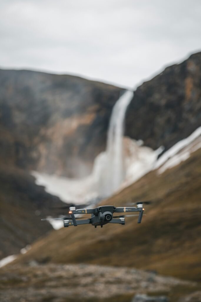
Drone photogrammetry involves using unmanned aerial vehicles (UAVs) equipped with high resolution cameras to capture overlapping images, that are then processed to create detailed 3D models, topographic maps, and orthomosaics of terrain. In the context of mining, this technology plays an important role in early-stage exploration by enabling rapid and cost-effective surveying of potential mineral sites without extensive ground disturbance. It supports geological mapping, identification of mineral indicators, and planning for further exploration activities. For gold, silver, and critical elements (i.e. lithium, nickel, copper, cobalt, rare earths), drone photogrammetry helps detect surface features, anomalies, and geological structures that may indicate underlying deposits.
Applications in Early-Stage Exploration
In the initial phases of mineral exploration, drone photogrammetry is used to generate high-accuracy digital elevation models (DEMs) and 3D reconstructions of landscapes, often far superior to traditional methods such as manned aircraft surveys. This allows explorers to identify fault lines, rock outcrops, and alteration zones that could signal mineralization. Combined with sensors such as LiDAR (Light Detection and Ranging) for enhanced topography data or multispectral cameras for detecting mineral signatures, drones facilitate non-invasive prospecting. Specifically, photogrammetry can produce GIS-compatible data in hours, reducing the need for on-foot traverses in remote or hazardous areas. [1]
Benefits of photogrammetry include cost savings, improved safety by minimizing human exposure to risks, faster data turnaround, and reduced environmental or habitat disruption. Challenges can include regulatory compliance for drone operations, weather dependencies, and the need for specialized software to process large datasets. [1]
Photogrammetry Use in Gold and Silver Exploration
For gold and silver, drone photogrammetry aids in mapping epithermal and orgenic deposits by highlighting vein structures, quartz alterations, and topographic features indicative of precious metal mineralization. In early stages, it supports drill targeting by creating detailed surface models that correlate with geophysical data. [2]
In the United States, companies such as Golden Lake Exploration and i-80 Gold have collaborated on drone-based surveys in Nevada’s South Eureka Gold Belt. Though primarily magnetic, these integrate with photogrammetry mapping for comprehensive site assessment in gold-rich areas. [3] In Canada, Great Bear Resources utilized drones for photogrammetry mapping at the Dixie Gold Project to minimize environmental impact while identifying targets. Further, Horizon Gold employed the technology for mapping water features at the Lake St. Joseph site. [4]
Use in Critical Mineral Exploration
Critical minerals, vital for cleaner energy technologies, benefit from drone photogrammetry in detecting pegmatite formations (for lithium) or magmatic intrusions (for nickel-copper). Hyperspectral imaging integrated with photogrammetry can identify discovery in unexplored regions. [5]
In Canada, Highland Critical Minerals conducted drone-based LiDAR and magnetic surveys at the Sy Property, Nunavut, supporting early-stage mapping for critical elements. [6] Further, SkyScout Exploration used drones to discover a nickel-copper deposit near Nipigon, Ontario, while DroneTech Canada deployed photogrammetry for lithium sites near Thunder Bay. [7] In the U.S, drone applications in Nevada for geothermal-related magnetic surveys indirectly aid critical mineral hunts, as seen in broader exploration efforts. [8]
Regional Examples
Canada’s vast and remote terrains make drone photogrammetry ideal. Pioneer Aerial Surveys, a Canadian firm, provides UAV-based services used by companies such as SSR Mining for high-resolution mapping in North American projects. [9] Geotech Ltd., employs photogrammetry at sites like De Beer’s Victor Diamond Mine, extending to critical mineral contexts in the Ring of Fire Region. [10] Overall, over 70 % of 2025 exploration projects incorporate such technology for sustainable practices. [11]
In the United States, drones enhance exploration in states such as Nevada and Alaska. Underground drone mapping at Northern Star’s mines in Alaska uses photogrammetry for 3D models, aiding gold and critical minerals assessments. [12] Further, the South Eureka collaboration demonstrates integrated drone use for gold belt mapping. [13]
Conclusion
Drone photogrammetry is transforming early-stage mining exploration by providing efficient and accurate tools for gold, silver, and critical mineral discovery in both Canada and the United States. As technology advances, its integration with AI and other sensors will likely further enhance sustainability and discovery rates, though ongoing regulatory regulations will be required.
Gold Proficiency
You can review the latest drone models from Oz Robotics here.
Sources:
[1] geologyforinvestors.com, www.geologyforinvestors.com/aerial-drones-in-mineral-exploration/ and orof.ca, https://www.orof.ca/mining-drones/
[2] safesightxp.com, https://safesightxp.com/2025/03/25/drones-for-mining-exploration-revolutionizing-the-mining/ and orof.ca, https://www.orof.ca/mining-drones/
[3] resourceworld.com, https://resourceworld.com/golden-lake-and-i-80-gold-to-collaborate-on-a-drone-magnetic-survey-on-their-respective-properties-in-the-south-eureka-gold-belt-nevada/
[4] orof.ca, https://www.orof.ca/mining-drones/
[5] safesightxp.com, https://safesightxp.com/2025/03/25/drones-for-mining-exploration-revolutionizing-the-mining/
[6] proactiveinvestors.com, https://www.proactiveinvestors.com/companies/news/1079859/highland-critical-minerals-launches-exploration-program-at-sy-property-in-nunavut-1079859.html
[7] orof.ca, https://www.orof.ca/mining-drones/
[8] sphengineering.com, https://www.sphengineering.com/applications/mining
[9] geologyforinvestors.com, https://www.geologyforinvestors.com/aerial-drones-in-mineral-exploration/
[10] orof.ca, https://www.orof.ca/mining-drones/
[11] farmonaut.com, https://farmonaut.com/mining/mineral-exploration-2025-tech-for-sustainable-mining
[12[ miningnewsnorth.com, https://www.miningnewsnorth.com/story/2024/05/31/news/drones-map-depths-of-northern-mines/8533.html
[13] resourceworld.com, https://resourceworld.com/golden-lake-and-i-80-gold-to-collaborate-on-a-drone-magnetic-survey-on-their-respective-properties-in-the-south-eureka-gold-belt-nevada/
Disclaimer:
This summary is based on publicly available information from various sources. It is provided for educational and informational purposes only. Though it has been taken to ensure accuracy, we make no representations or warranties of the reliability of the information.
Forward-looking statements, projections and estimates are subject to risks as outlined in the original company disclosures. Readers should consult official texts for full context. Nothing in the articles constitute forecasting, investment or financial advice. Please seek guidance from a qualified professional before making any investment decisions.